Tobacco Policy Viewer
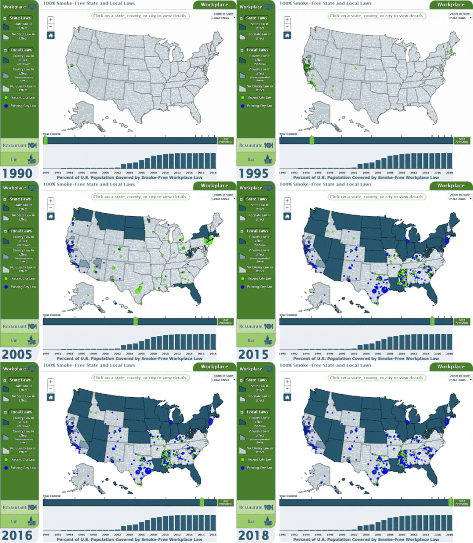
Implementation of smoke-free policies can lower smoking rates and reduce exposure to second hand smoke. The Tobacco Policy Viewer is an interactive web resource for mapping, query, and download of historical smoke-free policy data in the United States. The tool reveals variation across U.S. cities, counties and states in the types of indoor areas that are smoke-free, length of time since the smoke-free policy came into effect, and number of people who are protected by the smoke-free policy.
Uses
Cancer and tobacco control professionals and advocates can use the Tobacco Policy Viewer to identify gaps in smoke-free policy coverage and to inform planning for education and interventions in the areas of need.
Researchers can use the Tobacco Policy Viewer to facilitate analysis of the impacts of historical smoke-free policy coverage on reduction in secondhand-smoke exposures, tobacco use, and tobacco related diseases.
Capabilities
In the Tobacco Policy Viewer you can:
- Visualize changes in smoke-free policies in workplaces, restaurants, and bars.
- Let the tool animate over 5 year increments or manually select the display year in the timeslider control.
- Use controls in the legend to switch between viewing laws pertaining to smoking within Bars, Restaurants, or Workplaces.
- Show and hide the two layers of information; State smoking laws, or County and City smoking laws.
- Click on features to view information about currently displayed State, County, or City laws.
- Pan and zoom the dynamic webmap to investigate specific areas of the country.
Source
This information was compiled from local ordinance listings and using information from the American Non-Smoker's Rights Foundation "Chronological Table of U.S. Population Protected by 100% Smokefree State or Local Laws" located in Smokefree Lists, Maps, and Data
Additional Info and References
See the companion paper that describes the development of the Tobacco Policy Viewer:
A Geo-view into Historical Patterns of Smoke-Free Policy Coverage in the USA.
Zaria Tatalovich, David G Stinchcomb, Jeremy A Lyman, Yvonne Hunt, James E Cucinelli
You may also find The Tobacco Control Policy Tool useful. This tool provides estimates of the projected impact of four specific tobacco control policies on public health in the United States including cigarette taxes, smoke-free policies, tobacco control expenditures, and minimum smoking age.
Text View
This map application is not accessible to users of all assistive technologies. All of the statistics displayed in the application are available as data tables in an accessible text version.
